South Georgia, all red and orange. Here’s more detail.
It’s also worth remembering that while our Floridan Aquifer does recharge somewhat, that much of its water has been there since the last ice age. So if we keep mining water at a rapid rate, the aquifer will keep falling.
At Georgia River Network’s Weekend for Rivers, 31 March 2012, Diane Shearer presented “A-lap-a-WHAT?” About, you guessed it, the Alapaha River. She grew up in Alapaha, Georgia, and recently returned to find the source of its eponymous river and to trace its path.
Here’s a slideshow of my pictures of her presenting her pictures. I think she’s going to post her slides somewhere soon.
Diane is a retired public school teacher and writer. She is a member of Atlanta Audubon, Georgia Ornithological Society, Georgia Sierra Club’s Smart Energy Committee, and serves on the board of directors for the Initiative to Protect Jekyll Island. Her first attempt at expressing her love for the Alapha River was a column she wrote for Facing South in the early 1980’s called “In Praise of Rivers.”
Here’s a map of the Alapaha River watershed in green (blue is the Little River Watershed, wrapped inside the cyan Withlacoochee River watershed).
The Alapaha River is 190 miles long. It rises in southeastern Dooly County, Georgia and flows generally southeast along and through Crisp, Wilcox, Turner, Ben Hill, Irwin, Tift, Berrien, Atkinson, Lanier, Lowndes and Echols Counties in Georgia and Hamilton County in Florida. Along its course it passes the towns of Alapaha, Willacoochee and Statenville. The river flows into the Suwannee about 10 miles southwest of Jasper, Florida.
There’s a Withlacoochee Riverkeeper forming about the watersheds of the Alapaha, Willacoochee, Little, Withlacoochee, and Alapahoochee Rivers. If you’re interested, ask to join the facebook group or contact me, river at quarterman.org.
Since the 1970s, state and federal regulatory agencies have allowed the destruction of
more than 200,000 acres of highly critical wetlands throughout South Georgia to increase timber production and agricultural yields and usher in residential and commercial development. These wetlands that captured water and slowly released it to streams no longer perform that important function. The result has been increased floods when it rains and record low flows when it doesn’t….
the greatest concentration of wetlands is in the Coastal Plain of South Georgia. Though these forested foodplains and wetlands may not seem directly linked to our rivers and streams, they play an important role in holding water during rain events and dispensing it during dry periods. The sponges and kidneys of our state, they mitigate major floods, lessen the impacts of drought, and clean the water that passes through them, while regulating the amount of freshwater entering Georgia’s coastal estuaries where commercially important seafood find critical habitat. Additionally, these wetlands provide important habitat for waterfowl and other wildlife.
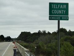
Driving south on US 441, we crossed the Ocmulgee River
entering Telfair County.
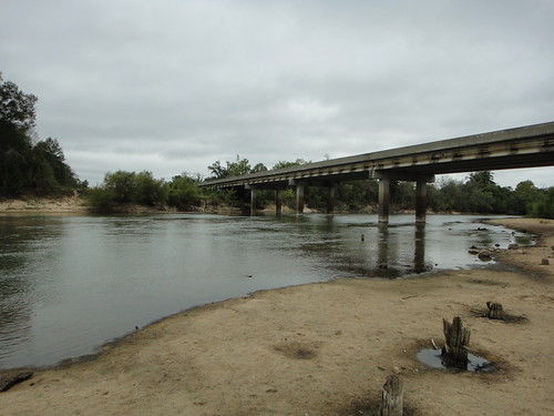
The river looked clean and was flowing, although clearly lower than it has been:
Those old bridge pilings has shells near them in the sand:
Continue reading →