Update 2022-01-12: Starlink Router inside 2022-01-10.
Turns out Starlink doesn’t work too well during thunderstorms. Other than that, so far so good.
![[Longleaf, solar panels, roof mount]](http://www.okraparadisefarms.com/pictures/2021-12-27--starlink/many.jpg)
Longleaf, solar panels, roof mount
Also looks good against longleaf pine. Continue reading
Fortunately, when the bee tree snapped off, it broke above the bee hive. So our pollinating native bees are still humming in and out of there. Their exit used to be on the other side of the tree, but they’re using this new entrance now.
I guess they will relocate, but at least they did not get suddenly evicted.
The bee tree was far from the largest of the fourteen big trees down we’ve counted so far. Two more were less than a hundred feet away towards the cypress swamp. Continue reading
A month of no rain ended mid-June, capped by 3.5 inches July 4th and another 3 inches July 5th, according to the bucket-and-yardstick rain gauge. Our cypress swamp, which had only puddles, is now full and overflowing.
![[3.5 + 6 inches of rain, cypress swamp]](http://www.okraparadisefarms.com/pictures/2021-07-05--bucket-rain-gauge-swamp-caterpillar/many.jpg)
3.5 + 6 inches of rain, cypress swamp
That chair was above the cypress swamp high water mark for this year. Now it’s in the water.
I’m renaming the front driveway Twin Creeks. Most of its flow goes into the swamp. Continue reading
Gretchen left these plants locked inside, but while she wasn’t looking they escaped.
They’ll have to go back inside tomorrow; freeze predicted. Continue reading
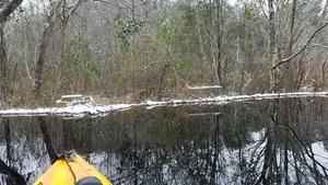
Snowmaggeddon was a good day to stay off the roads, so I took a kayak on our pond. Saw buzzards, heard some ducks and probably a beaver. Lots of plants looking very strange.

Movie: Wind and ice (16M), Beaver houses
Video

Movie: Icy beaver dam (20M), Between dams
Video
Video playlist.
-jsq
I did eventually break the ice for the dogs, but then they said the water was too cold. Lots of odd stuff during Snowmageddon.
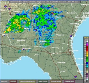
Continue readingCome on down this morning to PineVale Elementary and learn about growing things in our south Georgia subtropical climate! It’s rainy this morning and afternoon, and breezy all day; a great day for growing, and South Georgia Growing Local will be inside a new venue with cooking facilities!
 When:
9AM-4:30 PM, Saturday, January 21st 2017
Where: Pinevale Elementary School, 930 Lake Park Road, Valdosta GA.
Web: page with schedule.
If you’re still not convinced, watch Gretchen explain it on the radio with Continue reading